
01
Understand groundwater pathways
Visualise how groundwater may move between potential sources, aquifers, site boundaries and environmental receptors.
3D conceptualisation
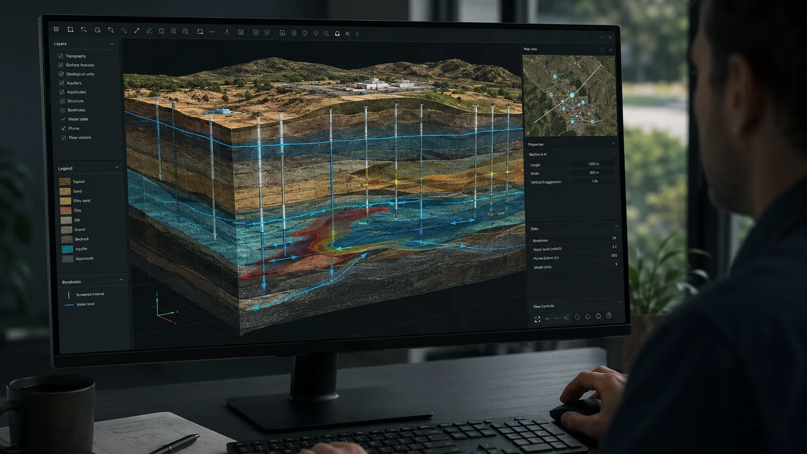
Soltera develops three-dimensional conceptual hydrogeological models that bring geology, aquifers, monitoring bores, groundwater behaviour, potential sources, migration pathways and receptors together in one clear visual framework.
A stronger conceptual model
Groundwater risk is inherently three-dimensional. Bore logs, geological units, aquifers, screened intervals, groundwater elevations and potential contaminant pathways are often difficult to communicate using separate plans, tables and two-dimensional cross-sections.
Soltera can integrate these datasets into a 3D conceptual hydrogeological model using specialist tools such as Seequent Leapfrog, where appropriate to the complexity and objectives of the project. The resulting model can be rotated, sliced and viewed from different perspectives to make aquifer architecture, monitoring coverage, pathways and uncertainty easier to understand and communicate.
Why it matters
A good 3D conceptual model supports technical decisions throughout the monitoring lifecycle and provides a common visual language for technical teams, clients, regulators and non-specialist stakeholders.
Visualise how groundwater may move between potential sources, aquifers, site boundaries and environmental receptors.
Use the conceptual model to assess spatial and vertical monitoring coverage, identify gaps and support bore location and target-depth decisions.
Explain complex hydrogeological relationships clearly to project teams, decision-makers, regulators and procurement stakeholders.
Identify inconsistencies, uncertainty and missing information that may need to be resolved through additional investigation or monitoring.
Bring potential contaminant sources, migration mechanisms and receptors together in a coherent three-dimensional framework.
Where required, the conceptual model can inform monitoring optimisation, technical interpretation and the scope of subsequent numerical modelling.
Typical applications
3D conceptualisation can add significant value where geology, multiple aquifers, contaminant pathways or monitoring objectives are difficult to understand in plan view alone.
3D conceptual groundwater modelling
Bring your bore logs, geology, groundwater levels and site risks together in a clear three-dimensional conceptual model.